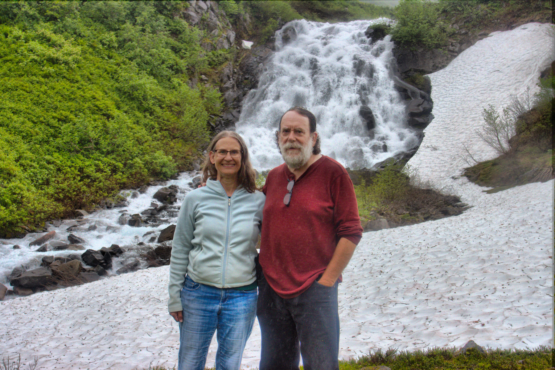
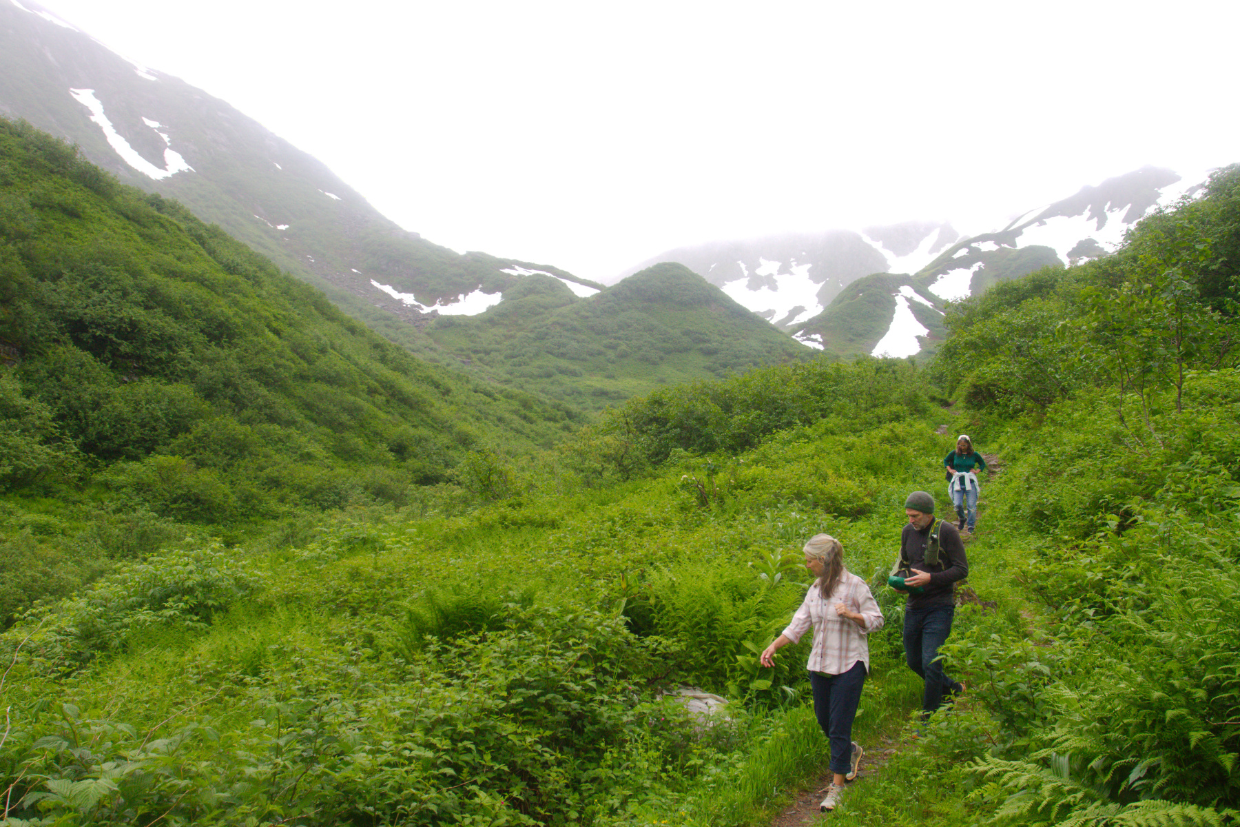
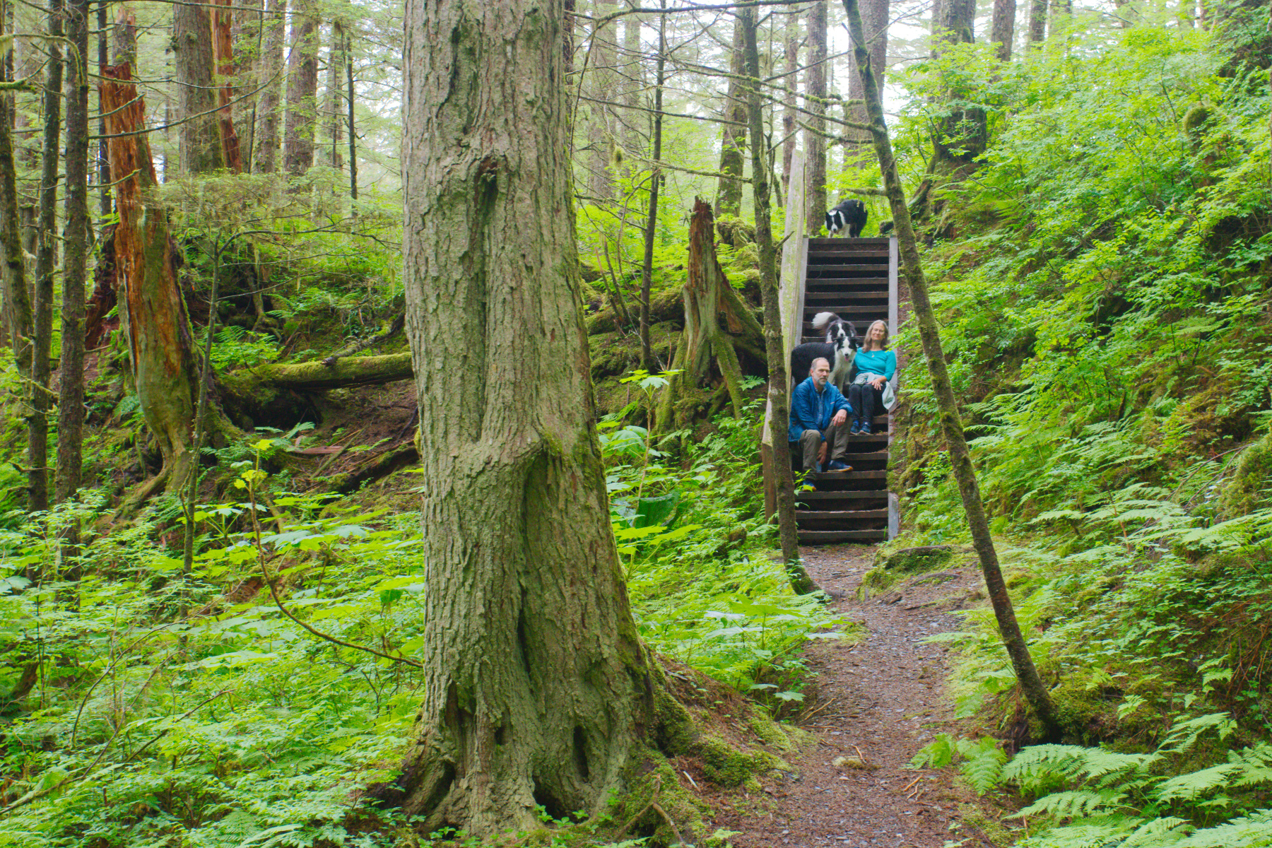
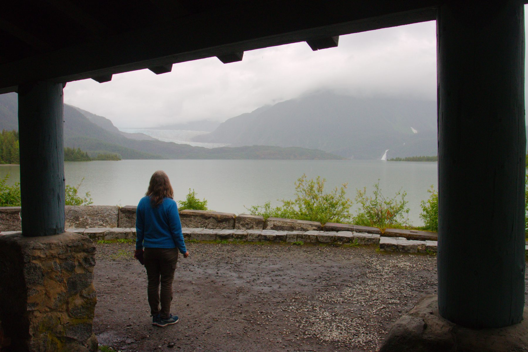
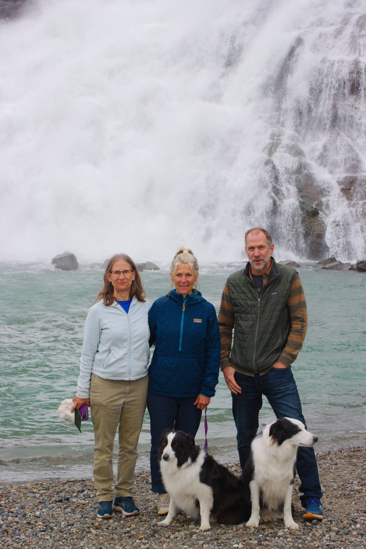
We went to the glacier again today, this time taking the short walk to Nugget Falls. When we lived here, the glacier came to about where we’re standing in this photo. It has receded quite a bit since then, which is a little sad, but glaciers have advanced and receded throughout history. Underneath the glacier are the remains of huge trees, frozen for quite a while, showing that the glacier has been considerably smaller than it is now for many, many years at some point it its history. It will advance again. In the meantime, Juneau may need to stop advertising it as a “drive up glacier.” It’s still quite impressive and worth going to see. One hike I wouldn’t have minded taking is the West Glacier Trail, which is the first real hike I took with Brian after we first met. I’d love to have photographs showing the difference in the glacier in 37 years. Maybe we’ll need to visit at least one more time. I also wouldn’t mind going up East Glacier Trail and Nugget Creek Trail. It’s more wooded but very pretty. We never went up that as far as Nugget Glacier, which would also be nice to do, some day. There are more trails in and around Juneau than can be hiked in two weeks, though. You have to pick and choose.
Tagged With: Juneau
Nugget Falls
Cathy, Point Louisa
When you decide to go to Juneau, you are making a tacit agreement to deal with rain. Depending on your source, there are between 180 and 235 days of rain per year in Juneau and there are only about 80 days described as ‘sunny’ per year. With the average high temperature in July, the hottest month, being only 64.1° it’s not the place to go to get a tan. That being said, we arrived late in the day on June 17 and didn’t have any rain the entire first week. Today was the first day we had to walk in the rain if we were going to walk. We drove with Brian, Lisa, and the dogs out to Auke Rec and walked to Point Louisa. The tide was out and this picture of Cathy gives you an idea of what the day was like. Actually, it wasn’t raining hard and we had a really good time being out. The tides in Juneau are pretty significant and where we were standing when this photo was taken will be under quite a few feet of water at high tide. The rocks are covered with barnacles and there are quite a few mussels, although not as many as on the rocks around Shaman Island, where we walked to on the 19th.
Granite Basin Hike
We took a long hike today. It was overcast and threatening rain but we only actually had a little drizzle for part of the hike. We started at the end of Basin Road. There are two branches at the lower end of the Perseverance Trail. The one we took is shorter but steeper. There is a door covering an entrance to the Ebner Adit and a very cool wind was coming out of it. I found that useful when we returned, because I was fairly warm. The first part of the trail is fairly steep and by the time you get to Ebner Falls, the first photo presented here, you’ve climbed 815 feet in about 0.7 miles, an average grade steeper than 1:5, although parts are closer to 1:3. The trail gets a bit easier at that point. You cross Gold Creek a few times and eventually get to the Granite Basin trail.
We passed a work crew on the trail. The near side of Gold Creek has been undermining the trail a bit so they were building gabions and filling them with rocks to stabilize the bank. It looked like hard work. One of them noticed my camera. I was carrying my 150-600mm zoom with the camera on it, mounted on a monopod. I also had two additional lenses, my 100mm macro and the 17-40mm zoom. She asked, “Are you going on a photo shoot?” Laughing to myself, I said “No, just taking pictures of whatever we see.“ She asked if I wanted to take their picture and when I said I would if they wanted, the all got excited. I took a few shots of them and got an email address to send them to. Oh, they also complemented my hat, which they said was ‘sick’ (which I’m pretty sure they meant as a compliment).
About a mile and a half up that trail, you take the left fork to stay beside Gold Creek. Another 0.6 miles or so and the Granite Basin Trail branches off on the left. This starts with five switchbacks and climbs quite steeply. After that the climb is a bit more moderate. We got to a point where there was a large snow drift covering both the trail and the entire value below the trail, with the stream going under it. Eventually we got to the cataracts below Granite Basin and stopped for a few pictures. We continued up into the basin but didn’t really go much further than that.
We had climbed from about 370 feet to about 1,750 over the course of about 4 miles (and then back again, totaling about 8 miles). It’s a beautiful hike and Granite Basin is really pretty. I remember the first time we hiked there the fireweed was in bloom, which was particularly nice. It’s not the easiest hike in the Juneau area but it’s one of my favorites. If you don’t mind a bit of exercise (and possibly crossing a bit of snow if you aren’t late in the summer) then I highly recommend this hike. It’s not a bad idea to bring water and a snack. The weather can be significantly different in Granite Basin from what it is at the start of the trail.
Bald Eagles
Cathy and I took a walk this morning with one of the dogs. We went up a trail along the west bank of Lemon Creek until the trail petered out. If the water wasn’t quite so high we’d have been able to continue but as it was, we had to turn around. We decided to go look for some eagles and we sort of hit the jackpot today.
I’ll be honest, as majestic as bald eagles ((Haliaeetus leucocephalus), they are basically scavengers. Sure, they will catch live fish and that’s beautiful to watch. But they will also eat dead and dying salmon that are running up the streams to spawn. When the salmon are running, eagles are easy to find around the mouths of those streams. However, we are a bit early for salmon, so the best place to find eagles right now is at and around the city dump.
There’s a gas station on Glacier Highway in Lemon Creek, next to the Western Auto and Marine store. At the back of the parking lot behind that gas station is a tall mound of dirt with weeds growing on it. Just beyond that is a line of trees, separating the parking lot from the landfill. The top of that mound of dirt is an excellent vantage for seeing eagles this time of year (or probably any time, be especially when the salmon are not so plentiful).
Taking pictures of birds on the wing is difficult with my huge, 150-600mm zoom lens. That’s especially true when it’s zoomed all the way out. Just finding a moving bird in the viewfinder is hard enough, but then getting it focused and the shutter fired before the bird has moved too far away or is seen only from behind is even more difficult. That being said, I’m quite pleased with a few of the shots I got of eagles flying. The first and last of the photos here are examples.
The second shot is of two trees across Glacier Highway with a total of ten birds in them. The third photo is of an eagle perched on the corner of a building. This bird let me get quite close, which surprised me a bit. I guess he knew he could get away before I could get to the top of the building. Anyway, while bald eagles are not at all rare in Juneau and the locals get fairly blasé about them, and even though we have a nesting pair within a mile of our house in Maryland, we’re still excited to see them.
Rainforest Walk
Cathy, Brian and I took a walk with the dogs through Switzer Meadow and then on a loop beyond Dzantik’i Heeni Middle School. Most of that later trail is in the woods, some of which is relatively young. The whole area was probably clear cut less than 100 years ago, so there are few if any trees older than that. Some areas seem to be pretty scrubby and one area looked like it was a homeless camp or party spot not too many years ago. It’s hard to tell because wood decomposes very quickly in this wet environment. It’s still a pretty walk for the most part and we enjoyed being out with the dogs.
False Outer Point
Today I have a pair of HDR photos, both taken from the beach near False Outer Point on Douglas Island. The first of them is Shaman Island, which we walked to at low tide on Monday. The tide was much further in this evening and you wouldn’t know that you could ever walk to it. In fact, the tide was coming in quickly. This image is two images stitched together using the Hugin Panorama Photo Stitcher and each of the source images for that are HDR images made from three exposures each.
The second photo is looking north northeast at the western side of False Outer Point with Spuhn Island visible to the left of it. The seaweed covered rocks in the foreground were quickly covered by the incoming tide. This is a nice beach to visit and it often very quiet and peaceful. It’s a short hike through the woods on the Rainforest Trail, which is a loop that takes you through some lovely temperate rainforest. In fact, if you happen to go to the Tongass National Forest page on Wikipedia and scroll down to the second photo on the page (which you can also see here), that’s a photo I took on this trail in September 20, 2004.
Skater’s Cabin
It was a fairly wet day today, one of the few rainy days we’ve had in our two weeks in Juneau. We went to church this evening (yes, on Saturday evening) and then Cathy and I drove to Skater’s Cabin on the southwest corner of Mendenhall Lake. Built in 1936 by the Civilian Conservation Corps, it can be reserved for group use for $10 per hour. It is about 200 yards from the West Glacier trailhead. The West Glacier Trail was one of my favorite hikes when we lived here, although it’s fairly steep in places, including what Brian and I call the Aztec Stairs, climbing about 750 feet in a little over a fifth of a mile of trail (a 63% grade). There are literal steps cut into the rock. I suppose technically that part of the trail is the Mount McGinnis Trail, but it’s all one trail to us.
Sundews on Dan Moller Trail
Another of my favorite trails in the Juneau area is the Dan Moller Trail on Douglas Island. We went up this with my parents and Albert in 1987 and one of my favorite pictures of my folks was taken from the top of the mountain, looking down on the cabin from above. This was also, I think, the first place we saw sundews in Juneau. There are two main species here and this is Drosera rotundifolia, the round-leaved sundew.
They are surprisingly common and at the same time, almost entirely overlooked. They grow in places that are constantly wet and at the same time sunny (or at least not shady). The slightly dryer parts of muskeg, where it’s almost constantly wet is generally the place. Once you see them, they seem to be everywhere, but until you’ve had them pointed out, they really aren’t very noticeable. The False Outer Point Trail is the other place we saw them. I understand that they are quite common on the Spalding Meadows trail, but we only did that on cross-country skis when the ground was covered with snow, so it wasn’t a good time to see them.
The sundews are not the only thing about the trail that I like. The combination of trees and open, meadow-like muskeg with its abundance and variety of wildflowers and plants is relaxing and beautiful to me. The Labrador tea (Ledum palustris), with its tiny, white flowers, the bog candle orchid (Platanthera dilatata, and many other little flowers are all over. None are terribly flashy but all are lovely in their own way. The usually dark water, the bright greens of the meadows, the darker green of the trees, the blue of the sky (when you are lucky enough to have a blue sky in Juneau), all combine to make a really pretty scene.
We also hiked a few miles on the Treadwell Ditch Trail, which is a relatively easy trail because it follows the contour of the land. It’s pretty, too, although quite different to the Dan Moller Trail, in spite of their very close proximity to one another. We also got a good view of downtown from the early part of that trail.
Mendenhall Puzzle
On June 6, 2023, I posted a photo of a common merganser (Mergus merganser) with ducklings on her back. They were swimming on Mendenhall Lake and it was taken at from the glacier overlook. Cathy and I really enjoyed that visit and in addition to the mergansers we saw arctic terns (Sterna paradisaea). Later that same day we returned to the Glacier with our friends Brian and Lisa. The overcast sky had partially cleared and there was a beautiful mix of blue and white, both overhead and in the reflections on the water.
I had this 1000-piece puzzle made from a photograph I took that evening and I’m really pleased with how it turned out. The sky was the hardest part although the water in the foreground was only marginally easier. With our love of puzzles, I think I might make more. But we have a few more waiting to be done, including one Brian and Lisa sent us recently with state flowers and birds.