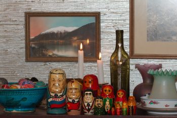
I didn’t have anything in particular to take a picture of today and didn’t get outside much, so I took this picture in our dining room. We’ve been moving things from both my mom’s house and Cathy’s mom’s house and adding things to what we already had. The photo in the center of this is a Winter & Pond photo titled “Lights o’ Juneau” On the left, the blue bowl filled with Easter Eggs is from Istalif, Iran. There are two sets of matryoshka or nesting dolls, one traditional (in the back and on the right) and one modern with (from largest to smallest) Boris Yeltsin, Mikhail Gorbachev, Leonid Brezhnev, Joseph Stalin, and Vladimir Ilyich Ulyanov (otherwise know as Lenin).
Tagged With: Juneau
Bric-a-brac
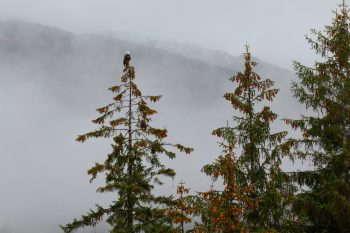
Bald Eagles in Lemon Creek
Well, we landed in Juneau after a long day of flights and layovers in Los Angeles and Seattle. We slept well and didn’t worry about getting up early (although I woke up at 7:00 anyway). We took a walk with the dogs in Lemon Creek, where Dorothy is living with our good friends, Brian and Lisa. The dogs, Kippen and Ayla, are border collies and are a lot of fun. The walk in Lemon Creek is surprisingly pretty for something so close to their house and it was nice to get out. The air was cool and it was raining very lightly but we knew what to expect and were ready for it. I got one photo with three bald eagles in it but I think this one is better. You can see the one at the top of the tree pretty easily but there is a second that’s not quite so obvious a little ways down on the right side of the same tree.
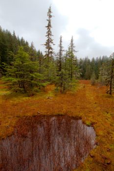
Muskeg
Near the confluence of the Eagle and Herbert Rivers, about 26 miles from downtown Juneau, there is the Eagle River Scout Camp. A trail leads from there along the south bank of the Eagle River to the open waters of Favorite Channel and Lincoln and Shelter Islands. Cathy, Dorothy, and I took the dogs and had a nice walk through the woods, along the river, and along the sandy shore. This photo was taken near the beginning of the walk in an open area in the woods.
A muskeg is “a nutrient-poor peatland characterized by acidic, saturated peat, and scattered or clumped, stunted conifer trees set in a matrix of sphagnum mosses and ericaceous shrubs.” I personally find them to be beautiful, although it’s not something you want to walk through if you can get around it. I particularly enjoyed the fall color as seen in this photograph as well as the reflections on the pool in the foreground. The sky was particularly overcast today and we only had glimpses of the mountains that would otherwise be in the distance. The overcast tends to heighten the colors, though, so that’s a plus. And the rain was barely noticeable until just before we got back to the car.
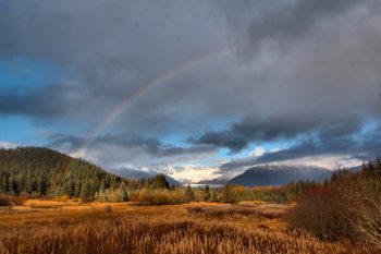
Rainbow Over Mendenhall
As mentioned in my previous post, it started raining as we returned to our car at the Eagle River trail near the Boy Scout Camp. It rained fairly hard but as we approached the Mendenhall River the sun came out and there was a rainbow to our left. We stopped at Brotherhood Bridge, where there’s a pretty decent view of the glacier and we had it framed by the rainbow. Rainbows can be tricky to photograph because the colors are fairly faint relative to other things in the photograph. Slight underexposure can help but that tends to make the rest of the shot dark. Anyway, This one turned out pretty well. At a different time of year, this photo would benefit from fireweed in the foreground, but the autumnal colors aren’t bad, either.
Airport Flats
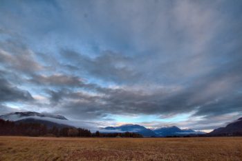
As mentioned in my earlier post for today, it was a busy day. In the afternoon we went for a walk with Brian and Lisa around the airport. It’s a pretty place and it’s not like the busy airports we’re used to from the DC area with planes taking off and landing one after the next all day. It’s a relatively quiet place except for the occasional plane and we had a nice time outdoors. If you need a reason to go to Juneau, here’s one. It’s beautiful regardless of the weather. The clouds were high enough today that we could see the mountains pretty well. We didn’t have a clear day the entire ten days we were there but if you need clear skies to enjoy a place, then maybe it’s not all it’s cracked up to be. The airport walk is an easy one, with virtually no hills to deal with. Very nice for a mid-afternoon walk. Highly recommended.
Treadwell
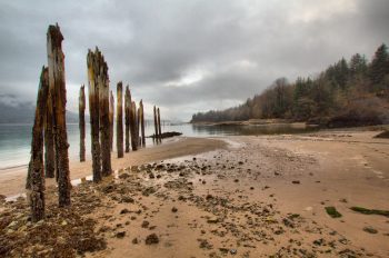
In 1898, Cathy’s great grandfather traveled from the iron mines of Michigan’s northern pinensula to the gold mines of Juneau. Specifically, he worked in the Mexican Mine in Treadwell on Douglas Island, across the Gastineau Channel. In 1917 the mine flooded and all work ceased. This photo was taken from near the cave-in site, which is on the extreme right although it’s not really visible. As you can see, it was more overcast than the previous two days, which were pretty nice. We couldn’t see the top of Mount Roberts across the channel. Nevertheless, it was good to get out and to walk where Cathy’s ancestors had walked (although we’ve been there before, of course). The Treadwell Mine’s office building, which was in pretty rough shape when we lived in Juneau, has been cleaned, painted, and given a new roof.
Mendenhall Glacier
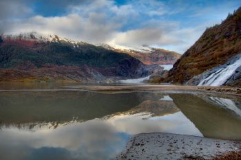
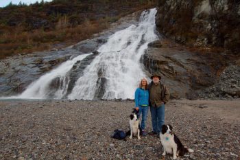
We went to the glacier today. In Juneau, that’s short hand for the Mendenhall, since it’s the one you can basically drive to. When we lived here in the late 1980s the face of the glacier was just a little past Nugget Falls, on the right in this photo. When my mother-in-law lived in Juneau, the face of the glacier was considerably further out into the valley. Like most (but notably not all) glaciers since the last little ice age, roughly between 1300 and the mid to late 1800s, it is receding. It’s still pretty and the clouds separated long enough for us to see some of the mountains around it, at least briefly, although you can’t really see them well in this photo.
Cathy at the Mendenhall
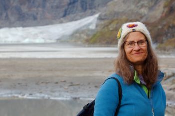
We have a very fond and somewhat funny memory from the winter of 1986-87. It was on a relatively mild day in February when Cathy, Brian, Lisa, and I drove out to the glacier. There was eight to ten inches of snow on the ice on Mendenhall Lake and there were kids sledding on the hills of glacial moraine. Brian, Lisa, and Cathy walked out into the snow on the ice wearing boots and their bathing suits. They took off the boots and settled on a blanket laid on the snow (which naturally sank into the snow when they sat down. I took a handful of photographs of them, pretending it was a lovely day. Actually, for February in Juneau, clear skies make it a lovely day, regardless of the temperature. Anyway, here’s Cathy, 32 years later, in front of the Mendenhall, although she was dressed more warmly today than she was on that day in February.
Cathy, Henry, and the Dogs
This photo wasn’t taken by me, but I’ve already posted two photos from today that I did take, so I think I can get away with it. I don’t appear in many photographs and for the most part, that’s my preference. Nevertheless, I’m trying to learn that if I want to expect others to let me take their picture, I need to be willing to return the favor. Dorothy took this with my camera and while I don’t think it’s a particularly good photo of me, it’s at least evidence that I was there. Nugget falls is larger than it looks in this photo. The reality is that we’re quite a ways from it. If we walked so that we were right below it, you’d see how high it really is. I have a few photos like that, but this isn’t one of them, so you’ll just have to trust me, or better yet, go visit it for yourself.
The Empty Chair
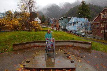
In May, 1942, the valedictorian at Juneau High School, John Tanaka, was absent because he and others of Japanses ancestry had been forcibly removed and incarcertated in government internment camps a month earlier. The graduating class left an empty chair in his honor at their graduation, honoring John and the other Japanese Americans. John’s younger brother, Bill, was in my mother-in-law’s class and naturally she remembers this incident. The Empty Chair Memorial is in Capital School Park between 5th and 6th Streets and Franklin and Seward.
Today was the rainiest day of our trip. While Dorothy was at work, Cathy and I spent the morning in the State Museum and Library, which I highly recommend. We also drove around downtown a bit with Dorothy after she got off work. That’s when this photo was taken. You can also get an idea from this photo of the steepness of some of upper Franklin Street.
Shrine of Saint Thérèse
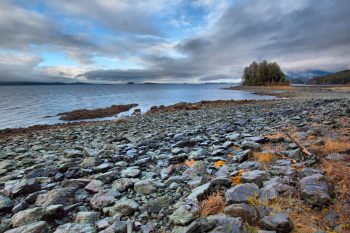
We went out to the Shrine of Saint Thérèse this morning and enjoyed a very pleasant walk onto the island (well, it was an island but is now connected by a causeway), into the chapel, and along a path on the shore (from which this photo was taken). It was cool and when we got there it looked like rain. Nevertheless, it didn’t actually come down and by the time we walked down the shore, there was some blue in the sky. If we see anyone else on any of our walks around Juneau, we like to joke that the place is getting overrun with tourists. Of course we’re tourists this time, and it’s only a joke anyway. There may have been a few other people at the Shrine the same time we were there but we hardly saw each other.
Granite Creek
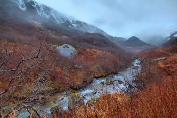
In addition to our visit to the Shrine this morning, Cathy, Dorothy, and I took our longest walk of the trip with Brian, Lisa, and their two dogs. We drove out Basin Road and went up Perseverance Trail and then a ways up Granite Creek Trail towards Granite Basis. I don’t know exactly how far we walked but it was at least three miles each way, possibly a little more. The Perseverance Trail goes up hill pretty significantly in places but it’s an easy trail to walk on. The view of Ebner Falls was nice, even in the light rain that was coming down. We turned off onto the much smaller Granite Creek Trail that zig-zags up a steep hill before becoming more gradual after that. We didn’t go too far up that and this photo was taken somewhere near where we turned around. It was after 5:00 PM and it was going to be dark before we got back. In fact, it was quite dark as we made our way past Ebner Falls and the rest of the way down, particularly those places under trees. But we didn’t lose anyone and had a really nice time.
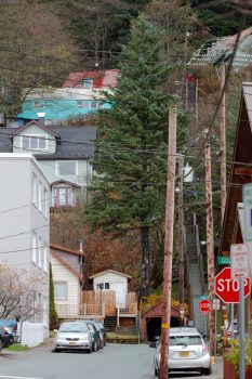
Fourth Street Stairs
When we first lived in Juneau, back in 1985 and 86, we rented the downstairs of the pale blue Quonset hut seen in the upper left of this photo. Our address was on Fourth Street but the street ended at Harris Street, almost two blocks away. To get to and from her job in the Goldstein Building, Cathy would walk down the long flight of stairs from above our house to Fourth and Harris. I don’t remember for sure how many steps there are, but my remembrance is that it’s 174 or so. Quite a few, anyway. In this photo you can see a person near the top of the stairs wearing a bright, red jacket.
We moved from the Quonset to an apartment on Douglas Island after a year or so and lived there the rest of our time in Juneau. Living in downtown Juneau certainly had its advantages, but it was also nice to have a few more windows as we did in the apartment. I’m not sure where I’d want to live if we moved back to Juneau. Land is at something of a premium, with usable land squeezed between the shore and the mountains and with so much given to National Forest. But I think I’d be inclined to be outside downtown at this point, just for the sake of having a bit more of a yard and garden.
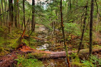
Tongass National Forest
One of my favorite hikes around Juneau is on the western extremity of Douglas Island. back in the 1980s there was a trail through woods, across muskeg, and to the shore. There is now a much shorter loop trail called the Rain Forest Trail that we took today. While I like the longer, older trail better, we didn’t have a huge amount of time to spend and it was also fairly wet as we drove out, with rain softly falling. You shouldn’t get the impression that the shorter trail isn’t very nice, because it’s actually wonderful. I took quite a few photos both in the woods and on the shore. This one is of a small pond just into the woods as we headed back on the southern part of the loop. The light in the woods is quite difficult, with fairly low light levels along with a very bright sky showing through. I’m pretty pleased with how this one turned out.
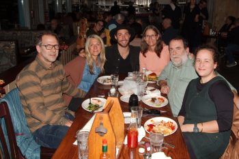
Brian, Lisa, Nathaniel, and Us
It’s our last evening in Juneau and we went out to dinner with our good friends Brian and Lisa and their son Nathaniel. This photo was taken by Nathaniel’s girlfriend, Alex and it’s nice to have a picture with all of us in it. We were sad to be leaving and could easily have been happy staying another week or even two. We’ve know Brian and Lisa since early 1986 and Dorothy’s been living with them since she arrived in mid July. I’d say it’s been very good for her to be here, although not without its struggles. But as a wise man once said, “Life is pain, highness. Anyone who tells you different is trying to sell you something.”
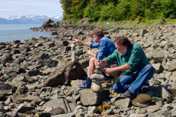
Rock Balancing
As you might guess, although I take most of the pictures with my camera, Cathy took this shot. We had driven to the end of the road and then walked to the shore just past Echo Cove. This is as far as you can drive from downtown Juneau. It was sunny and hot, which is unusual for Juneau, but we enjoyed being out. Cathy and Lisa were down near the water and Brian and I sat higher on the rocky beach and started balancing stones. It’s a fiddly thing but soothing in its own way. We each managed to get a respectable cairn built and Cathy took a few pictures as we worked on our final stones. The horse flies started to bother us, so we headed back to the car and back to town for the evening.
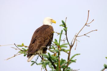
Bald Eagle (Haliaeetus leucocephalus)
After breakfast and some time writing in my journal this morning I decided to see if I could get some pictures of eagles. I know the people living in Juneau are so used to them that they don’t even notice them much of the time. We have a pair nesting less than a mile from our house (as the eagle flies) but we’re still excited to see them. When trying to decide what to bring on this trip, I was determined to bring my new 150-600mm zoom lens. I had to rearrange my camera bag and leave a few other things out, but I’m glad I brought it. Today was my first opportunity to get a really good view. There was a large dirt pile, probably 25 or 30 feet high, behind a gas station and in the tree tops beyond that were eagles. My presence made a few of them nervous and a couple flew away, but others, including this handsome bird, stayed and let me get some really nice photos.
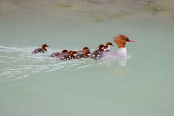
Common Merganser and Ducklings (Mergus merganser)
Cathy and I went to the glacier this afternoon. By ‘the glacier’ I mean the Mendenhall. We had been in the valley at a cemetery looking for the grave of one of Cathy’s mom’s siblings (we found it) and since we were close, we decided to head to the glacier and see what we could see. It was mostly cloudy, but not raining and still quite pretty. There are arctic terns (Sterna paradisaea) nesting on the shore of Mendenhall Lake and I was able to get a few decent photos of them. But my favorite is this one of a common merganser (Mergus merganser) with ducklings on its back and following it along. There were ten ducklings in all, although you can only see nine in this photo.
On Mount Roberts
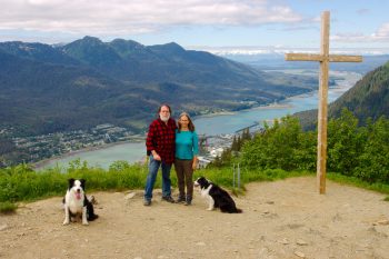
Cathy, Brian, two dogs, and I hiked up Mt. Roberts today. We started from the trailhead on Basin Road (elevation about 280 feet above sea level). The trail goes up pretty steeply but we’ve done it before, so there were no surprises. A few people passed us when we stopped to rest at a log bench but we passed a few others, so we were not the slowest hikers out there.
We made it past the upper station of Goldbelt Tram at about 1,800 feet elevation. We continued up to Father Brown’s Cross, know to Cathy’s family at Muriel’s Cross. Father Brown put up the original cross in 1908 but it has been replaced many times over the years and a bunch of these times were by Cathy’s cousins, who happened to own a lumber yard and hardware store, putting them in a good position to do that. Muriel, Cathy’s aunt, was the matriarch of that branch of the family so they refer to it as Muriel’s Cross.
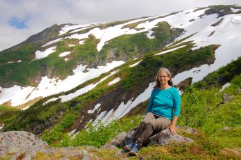
Brian took the first of these photos. Then he and the dogs headed down, running back down the way we came up. He had to pick up Lisa, who had been working. Cathy and I continued higher up and I took quite a few wildflower photos as well as a nice panorama of Mounts Juneau and Roberts.
We took the tram down. They make that harder than they used to do. You must have a receipt from the restaurant or the gift shop for at least $20. But they don’t have it well advertised, so we waited in line and then had to get out of line and wait again. There really isn’t anything we wanted from the gift shop, but they don’t give you the option of simply paying them $20, which seems kind of stupid. My advice would be to look for a receipt left behind by someone who already had a round trip ticket.
The sky was cloudy when we headed up but it got clearer as we went up. I should have worn a short sleeve shirt and was quite warm in flannel. Nevertheless, we really enjoyed ourselves. This is one of our favorite hikes, even though it’s steep and it is one of the more crowded trails, especially above the tram. It’s worth it, especially when the sky is clear. The view is wonderful.
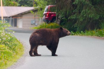
Cinnamon Bear
Brian was working this morning and Lisa took the dogs for a walk. I got a call from Lisa saying she was coming back from her walk and there was a bear in the front yard. I grabbed my camera and went outside. By the time I got there the bear was crossing the street in front of the house just up the street. I got a few photos of it from behind and then it turned and I was able to get two of the bear in profile. I got in the car to try to follow it as it moseyed up the street and but it turned off onto a trail towards Lemon Creek. I went past the beginning of the trail and then turned around, only to have the bear come out of the trees and cross the road again and go under a fence and through another yard. I headed around the block and saw it again. Unfortunately I wasn’t able to get any more pictures except taken through the car windscreen, so they aren’t terribly good. After taking the last couple, a guy who was hanging out on a balcony asked me, “you came into this neighborhood to photograph bears?” I sort of explained but I think he thought I was crazy.
Although this bear is brown, it is an American black bear (Ursus americanus). They range in color from a fairly light blond, through this beautiful brown, to entirely black. Those that are brown are often called cinnamon bears.

